See your land
from above.
Act on the ground.
FieldEye turns satellite imagery and your own observations into simple, affordable insights — helping operators, miners, farmers and contractors monitor what matters most.
ag programmes reach
subscription
agriculture & mining
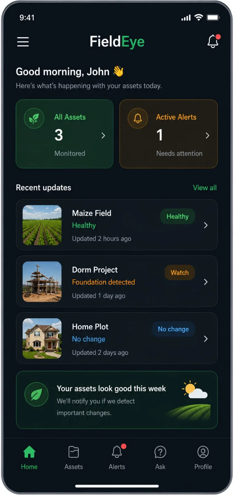
A simple app that gives your fields and sites a second set of eyes
FieldEye is a mobile application that captures geo-tagged field observations and combines them with satellite imagery. You record what's happening on the ground; FieldEye combines it and together it builds a clear, continuously updated picture of your land, crops or operations that you can trust and share.
For farmers
Monitor crop health across the season, get location-based insights on your plots, and keep a digital record of every field activity — all from an affordable app on your phone.
- ✓ Crop & vegetation monitoring from satellite
- ✓ Early alerts when something changes
- ✓ Simple digital farm records
For miners
Small and medium-scale mining operations use FieldEye for operational reporting, site inspections, asset monitoring and trusted digital record management — the evidence base for financing and responsible sourcing.
- ✓ Operational reporting & inspections
- ✓ Asset & site monitoring
- ✓ Verifiable digital records
Everything in one simple app
Geo-tagged capture
Record field activities and observations, pinned to their exact location.
Satellite monitoring
Continuous views of your land from Copernicus Sentinel-1 & Sentinel-2.
Early alerts
Get notified when the app detects a change worth acting on.
Digital records
A trusted, shareable history of your fields, sites and operations.
Guided insights
Ask questions and get location-based operational insights in plain terms.
Affordable
A low monthly subscription starting from $20 — built for small producers.
Ready to see your land clearly?
Open FieldEye and start monitoring your fields or site today.
From the field and the sky, into one clear view
FieldEye brings together two kinds of information — what you see on the ground and what satellites see from above — and uses AI to turn them into insights you can act on. Here's the journey.
You capture the ground truth
Using the mobile app, you record geo-tagged field observations and activities — what's growing, what's happening on site, what's changed. Each entry is pinned to its exact location and time, building a reliable ground record.
We add the view from space
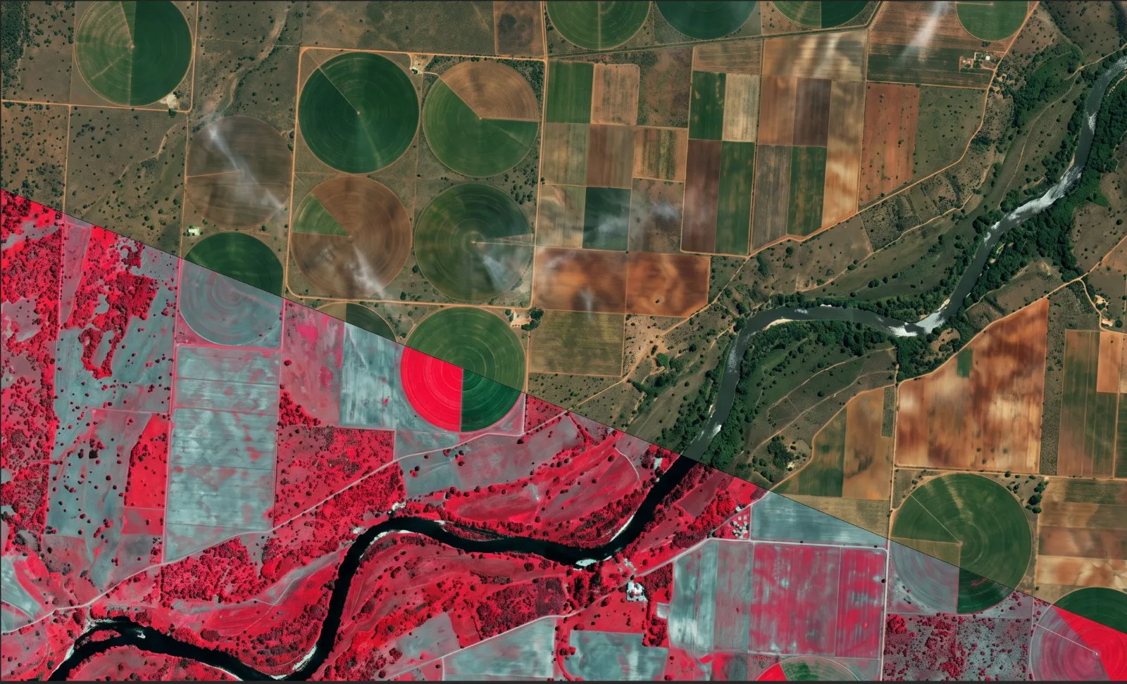
FieldEye pulls Earth Observation imagery from the European Copernicus programme — Sentinel-1 radar and Sentinel-2 optical satellites — over your location, giving you a continuously refreshed view of your fields or site.
AI turns data into insight
Your ground observations and satellite data are fused together. AI analyses them to highlight meaningful changes, generate location-based operational insights, and raise early alerts.
You act — and keep the record
You get clear updates and alerts on your phone so you can act early. Every observation and insight becomes part of a trusted digital record you can revisit, and that supports financing, inspections and responsible sourcing.
What powers FieldEye
Copernicus Earth Observation
The world's largest Earth Observation programme provides Sentinel satellite data — the primary imagery source behind FieldEye.
Verified field intelligence
Your geo-tagged observations become the ground-truth layer that makes the satellite view accurate and locally relevant.
Trustworthy AI
Transparent, human-centric analytics with human verification and explainable decision support — insight you can question and trust.
Try it on your own field or site
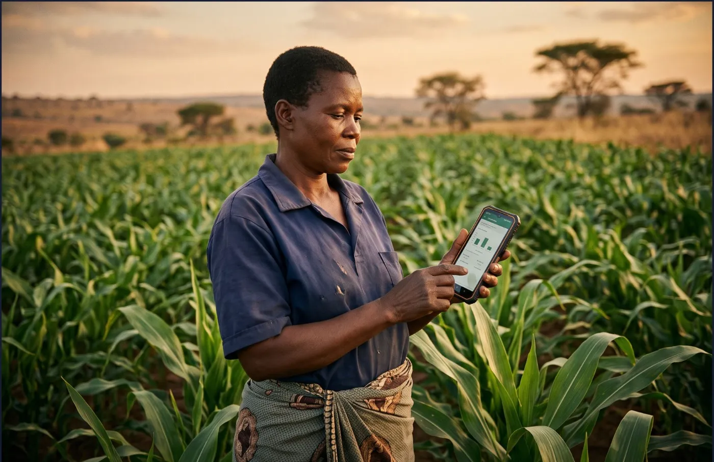
FieldEye runs on your phone — no special equipment needed.
Builders across Zambia, Europe and beyond
FieldEye is built by ADIP — a team combining frontier-market experience, supply chain expertise, finance, and Earth Observation & AI engineering.
Leadership
Sankey Chibale
Supply chain & digital transformation specialist (MIT SCALE). Former EU Business Manager at Amazon, with a telecom engineering background.

Manuel Dreweck
AI specialist. Leads product, EU go-to-market and ecosystem building from Bremen.

Ruth Simwanza
Banking and microfinance executive (CEO/COO roles), with deep expertise in financial regulation and value-chain financing.
Vipul Solanki
Senior engineer with 10+ years in Java, Spring Boot and AI/ML document processing. Builds FieldEye's backend, data pipelines and platform integrations.
Advisors & consultants

Dr. Albert Tan
Associate Professor at the Asian Institute of Management and part of the MIT Center for Transportation & Logistics ecosystem.
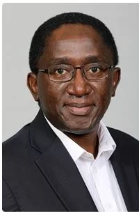
Dr. Mjumo Mzyece
Engineer and Duke MBA with international R&D and leadership experience at IBM, Econet Wireless and Agilent Technologies.

Ngalazu Phiri
Founder of KNG-Equity Group, advising SMEs and investors on capital raising and de-risking across finance, infrastructure and impact.
Working with us on the ground
FieldEye's rollout is supported by an ecosystem of partners including pilot customers in Zambia (CBK Mining), value-chain finance partners, farmer cooperatives, and Bremen's startup ecosystem — with Copernicus and European Earth Observation as its data backbone.
Let's talk
Whether you're a farmer, a mining operator, a cooperative, or a partner organisation — we'd love to hear from you and help you get started with FieldEye.
Disclaimer
Last updated: July 2026
Informational purpose
This website provides general information about FieldEye, a product of ADIP. FieldEye is currently being introduced in Zambia, initially for agriculture and subsequently for small and medium-scale mining. The content here is for informational purposes only and may change as the product develops.
Guidance, not guarantees
FieldEye provides operational insights derived from satellite imagery, user-submitted field observations and AI analysis. These insights are intended to support — not replace — your own judgement and professional agronomic, engineering, financial or legal advice. FieldEye complements existing audit, inspection and due-diligence processes rather than replacing them.
Satellite & data limitations
Earth Observation data (including Copernicus Sentinel imagery) can be affected by cloud cover, revisit timing, resolution limits and other factors. Insights and alerts are estimates based on available data and may contain inaccuracies or delays. Always verify important decisions on the ground.
No financial or investment advice
Nothing on this website or within FieldEye constitutes financial, investment, or credit advice, nor an offer of any financial product. References to financing, bankability or compliance describe intended platform capabilities and do not represent guarantees of any outcome.
Limitation of liability
To the fullest extent permitted by applicable law, ADIP and its team accept no liability for any loss or damage arising from reliance on information provided on this website or through FieldEye. Use of the app is subject to its own terms.
Third-party references
References to programmes, institutions, partners or pilots (including Copernicus, the European Space Agency, Zambian government programmes, and named partners) are for descriptive purposes and do not imply endorsement unless explicitly stated.
Contact
Questions about this disclaimer? Reach us at info@fieldeye.earth.
Datenschutzerklärung
Stand: Juli 2026 · Gemäß Art. 13 & 14 DSGVO
1. Verantwortlicher
Verantwortlich für die Datenverarbeitung auf dieser Website im Sinne der Datenschutz-Grundverordnung (DSGVO) ist:
[Straße und Hausnummer]
[PLZ] , Deutschland
Vertreten durch: .
E-Mail: info@fieldeye.earth
Hinweis: Handelsregister, USt-IdNr. und Telefonnummer werden ergänzt, sobald die ADIP GmbH final eingetragen ist.
2. Grundsätzliches
Der Schutz Ihrer personenbezogenen Daten ist uns wichtig. Diese Website dient ausschließlich der Information über FieldEye. Es findet kein Tracking, keine Analyse des Nutzerverhaltens und keine Werbung statt. Es werden keine Profile gebildet und keine Daten an Werbenetzwerke weitergegeben. Personenbezogene Daten verarbeiten wir nur, soweit dies technisch notwendig ist oder Sie uns aktiv Daten übermitteln (z. B. über das Kontaktformular).
3. Hosting
Diese Website wird bei der IONOS SE, Elgendorfer Straße 57, 56410 Montabaur, Deutschland, gehostet. IONOS verarbeitet in unserem Auftrag Daten, die beim Besuch der Website anfallen (siehe Server-Logfiles). Grundlage ist ein Vertrag über Auftragsverarbeitung gemäß Art. 28 DSGVO. Die Verarbeitung erfolgt zur Wahrung unseres berechtigten Interesses an einer sicheren und zuverlässigen Bereitstellung (Art. 6 Abs. 1 lit. f DSGVO).
4. Server-Logfiles
Beim Aufruf der Website werden durch den Hosting-Provider automatisch Informationen in Server-Logfiles gespeichert: IP-Adresse, Datum und Uhrzeit des Zugriffs, aufgerufene Seite, verwendeter Browser und Betriebssystem sowie die zuvor besuchte Seite (Referrer). Diese Daten dienen der technischen Bereitstellung, Sicherheit und Fehleranalyse. Rechtsgrundlage ist Art. 6 Abs. 1 lit. f DSGVO. Die Logfiles werden nach spätestens 30 Tagen gelöscht bzw. anonymisiert.
5. Kontaktformular und Kontakt per E-Mail
Wenn Sie uns über das Kontaktformular oder per E-Mail kontaktieren, verarbeiten wir die von Ihnen angegebenen Daten (Name, E-Mail-Adresse, Rolle sowie Ihre Nachricht) ausschließlich zur Bearbeitung Ihrer Anfrage. Die Übermittlung erfolgt an info@fieldeye.earth. Rechtsgrundlage ist Art. 6 Abs. 1 lit. b DSGVO (vorvertragliche Maßnahmen) bzw. Art. 6 Abs. 1 lit. f DSGVO (berechtigtes Interesse an der Beantwortung). Ihre Angaben werden gelöscht, sobald die Anfrage abschließend bearbeitet ist und keine gesetzlichen Aufbewahrungspflichten entgegenstehen.
6. Schriftarten
Zur einheitlichen Darstellung nutzt diese Website die Schriftarten „Sora“ und „Manrope“. Diese sind lokal auf unserem Server gespeichert und werden von dort ausgeliefert. Es findet dabei keine Verbindung zu Servern Dritter (insbesondere Google) statt und es wird keine IP-Adresse an Dritte übermittelt.
7. SSL-/TLS-Verschlüsselung
Diese Seite nutzt aus Sicherheitsgründen eine SSL-/TLS-Verschlüsselung. Eine verschlüsselte Verbindung erkennen Sie am „https://“ in der Adresszeile Ihres Browsers.
8. Ihre Rechte als betroffene Person
Ihnen stehen nach der DSGVO folgende Rechte zu: Auskunft (Art. 15), Berichtigung (Art. 16), Löschung (Art. 17), Einschränkung der Verarbeitung (Art. 18), Datenübertragbarkeit (Art. 20) sowie Widerspruch gegen die Verarbeitung (Art. 21). Erteilte Einwilligungen können Sie jederzeit mit Wirkung für die Zukunft widerrufen. Zur Ausübung Ihrer Rechte genügt eine formlose Nachricht an info@fieldeye.earth.
9. Beschwerderecht bei der Aufsichtsbehörde
Sie haben das Recht, sich bei einer Datenschutz-Aufsichtsbehörde zu beschweren. Zuständig ist die Landesbeauftragte für Datenschutz und Informationsfreiheit der Freien Hansestadt Bremen, sowie jede andere Aufsichtsbehörde Ihres Wohnorts.
10. Änderungen dieser Datenschutzerklärung
Wir passen diese Datenschutzerklärung an, sobald sich die Rechtslage oder unsere Verarbeitungen ändern (z. B. mit Einführung von Nutzerkonten oder weiteren Funktionen). Es gilt die jeweils aktuelle, hier veröffentlichte Fassung.
Impressum
Angaben gemäß § 5 DDG (Digitale-Dienste-Gesetz)
Diensteanbieter
1311 Buungano Office Park
Rhodes Park, Lusaka
Sambia / Zambia
Kontakt
E-Mail: [EMAIL: info@fieldeye.earth]
Telefon: [TELEFON, sobald verfügbar]
Vertretungsberechtigte
[RESPONSIBLE PARTY / vertretungsberechtigte Person(en)]
Register & Umsatzsteuer
Handelsregister / Umsatzsteuer-Identifikationsnummer: [VAT/Register no. once available]
Verantwortlich für den Inhalt
Verantwortlich i. S. d. § 18 Abs. 2 MStV: [RESPONSIBLE PARTY], 1311 Buungano Office Park, Rhodes Park, Lusaka, Sambia.
Haftung & Streitschlichtung
Trotz sorgfältiger inhaltlicher Kontrolle übernehmen wir keine Haftung für die Inhalte externer Links; für deren Inhalt sind ausschließlich deren Betreiber verantwortlich. Die Europäische Kommission stellt eine Plattform zur Online-Streitbeilegung (OS) bereit: ec.europa.eu/consumers/odr. Wir sind nicht verpflichtet und nicht bereit, an Streitbeilegungsverfahren vor einer Verbraucherschlichtungsstelle teilzunehmen.